

By Alexander Wasse
East of the bustling streets of modern Amman, the Mediterranean hill-country quickly gives way to drab plains extending to the Azraq oasis. Fractured basalt here marks one’s entry into the Black Desert, a tangle of blue-black boulders and pale mudflats which spill into Arabia from the Jebel Druze uplands in southern Syria, blocking the long road east to the Mesopotamian rivers. The Qurma Gap, a west-east corridor of comparatively open terrain, affords a natural route through the worst of the basalt country, which otherwise impedes access for almost 100km.
In prehistory, the Qurma Gap and its flanks were home to the Black Desert Neolithic cultures, its beating heart vast, ceremonially elaborated aggregation sites such as Ghirqa Pools and Wisad Pools. Here hundreds of beautifully preserved prehistoric structures cluster around rockpools close to the basalt’s edge. Building on pioneering work by Henry Field in the 1920s and Alison Betts in the 1980s-90s, our multidisciplinary Eastern Badia Archaeological Project (Ar. bādiya: “desert”; “steppe”) has been active here since 2008. Genuine crossroads on the steppe in a Late Neolithic era of transregional connectivity, these 8,000-year-old sites balanced cultural influences from the Levant, Mesopotamia and Arabia with the maintenance of autochthonous integrity.
As rightly emphasised by Alison Betts, in “no sense does the badia need to be explored since it has been home to so many peoples over so many centuries.” With regard to the mechanical era, archaeologists were by no means the first outsiders to penetrate its expanse. Following Britain’s assumption of Mandatory responsibilities in the Middle East after the First World War, the so-called desert corridor between Egypt and Iraq found itself a key link in a chain of modernising communications connecting London with India, and ultimately Singapore and Australasia. It was RAF pilots flying the Cairo-Baghdad air mail through the Qurma Gap in the 1920s who first realised the Black Desert’s archaeological potential and brought it to wider scholarly attention.
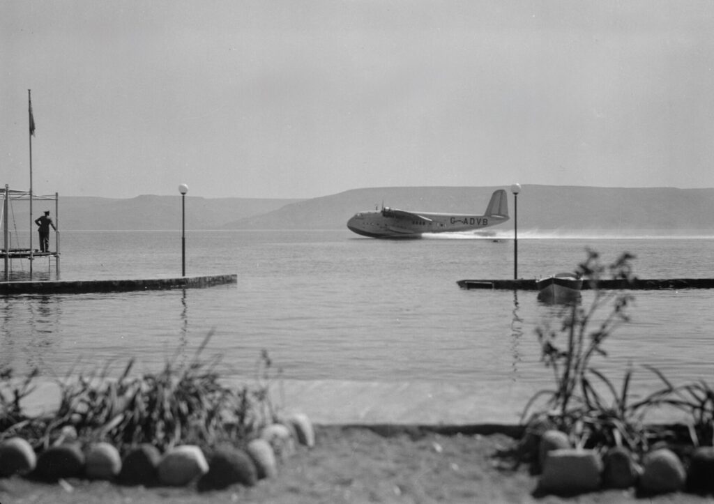
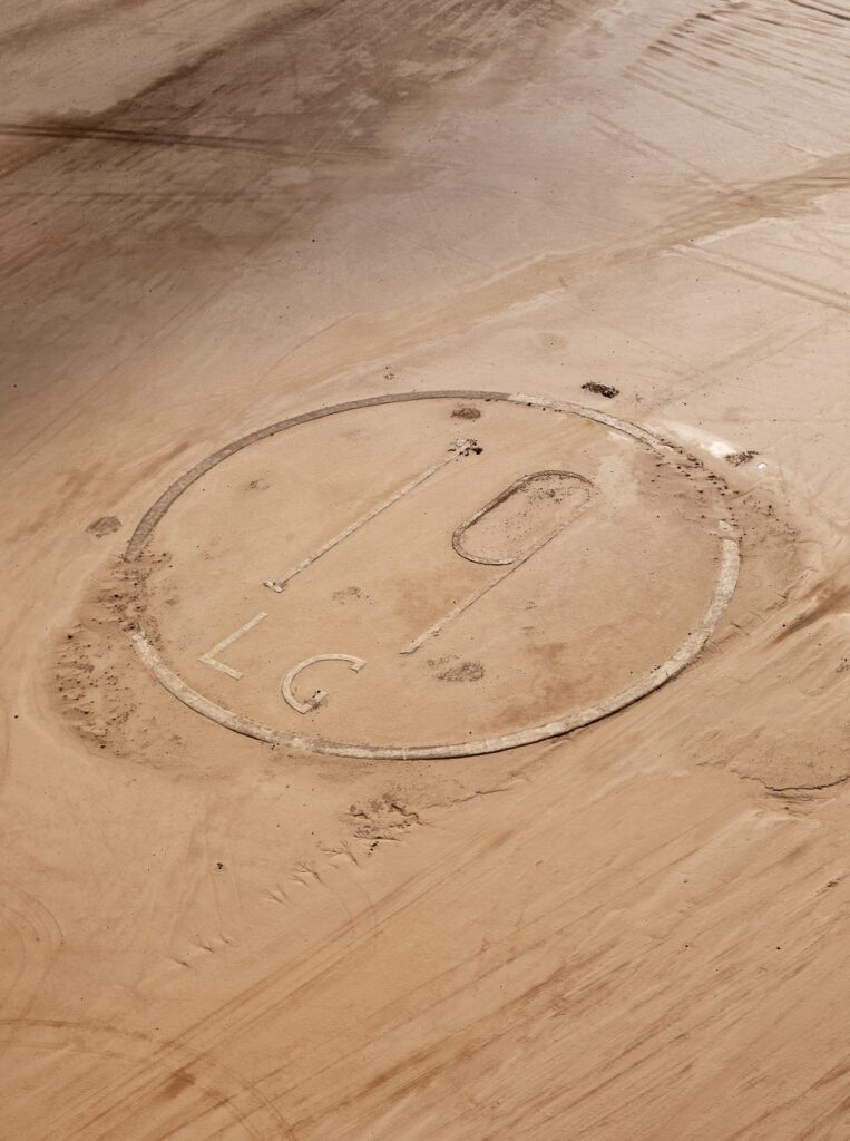
The demands of maintaining a secure corridor for air routes, motor routes, pipelines and a never-realised Haifa-Baghdad railway shaped post-war borders and bound the desert into colonial administrative structures. Owing to the political vicissitudes of the mid-20th century, traces of this breathtakingly confident yet ultimately short-lived expression of imperial ambition can be hard to discern. A few dusty settlements cling to the modern Baghdad highway, itself following the 1934 pipeline between the Kirkuk oilfields and Haifa. Modern fighter jets reheat noisily over airfields once traversed by luxurious flying boats (Figure 1). Further into the desert, lonely cairns stand smartly to attention along tracks surveyed by Maj A.L. Holt RE. Look more closely and telling details emerge. Here, the curved corner of a building more Streamline Moderne than vernacular. There, forgotten landing grounds marked in font that wouldn’t be out of place on the London Underground (Figure 2). At the H5 pumping station there is even a desert cinema, perhaps the earliest in Jordan.
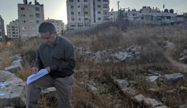
In our early seasons of fieldwork, we rattled unwittingly between prehistoric sites along hundred-year-old motor tracks which remain vital access routes to this day. Over time, we realised that the spectacular landscapes of the Black Desert harbour a globally significant aviation heritage that is all but unknown. Eastern Jordan not only witnessed the birth and rapid development of international air travel in the 1920s-30s, but owing to its remoteness remains amongst the best-preserved locations for its archaeological investigation worldwide.
Although a desert air route operated by the RAF was first proposed in 1919, it wasn’t until 1921 that a Cairo-Baghdad air-mail service was established (Figure 3). Owing to the featureless terrain between Amman and Hinaidi/Habbaniya, the route was here marked with huge directional arrows (Figure 4), a ploughed furrow for pilots to follow and emergency landing grounds – designated on the ground by a letter or number in a circle – at approximately 30km intervals. The RAF operated the route until 1926, after which Imperial Airways took over with a civilian service. Around 1932, the route was straightened, with new ground markers being placed right through the basalt. Upgraded navigational equipment, eventually including automated airway beacons (‘desert lighthouses’), allowed for night flying and the compression of schedules. Much of this infrastructure has survived, but it has not been systematically studied and is frequently at risk of destruction.

Following a pilot season in 2024, the Desert Air Routes Project was initiated in 2025. With the aspiration to work between Cairo and Basra, it seeks to record what remains, to undertake contextualising documentary research, and to assess the lasting impact of these routes in Egypt, Palestine/Israel, Jordan and Iraq. To date, we have documented ground infrastructure along more than 400km between Qasr al-Hallabat, approximately 25km east of Zarqa, and Jordan’s border with Iraq. Collaboration with the Aerial Archaeology in Jordan project has generated a superb archive of low-level aerial imagery, with the Jordanian-desert sectors of the routes being flown in December 2025.

Generous support from the CBRL recently allowed three weeks to be spent in London archives. This transformed our understanding of the archaeological dataset, to say nothing of unlocking a trove of contemporary photographs. The desert air routes cannot be understood without reference to British imperial communications at the highest strategic level, encompassing defence, oil supply, capital flow, public-/private-sector cooperation and road/rail investment. We see also how they functioned as technological incubators, evidenced by aspirations not only to operate 700-foot airships between Egypt and India, but also to light the entire route! At the operational level, a 300-page file in The National Archives gives day-by-day insight into the sheer effort invested in the 1921 surveys by which the route was established. 30 Sqn RAF alone put in 645 hours’ flying time, covering no less than 48,375 desert miles. It is notable, too, how importance was attached to political engagement with tribal leaders, such as Nūri al-Sha’lān of the Rwala (Figure 5) who seems consistently to have been one step ahead of the survey teams.

The work of the Desert Air Routes Project is just beginning, with the recent identification of landing grounds associated with the RAF’s 1934 Transjordan-Saudi Frontier Air Survey driving that realisation home (Figure 6). Conditions which resulted in the remarkable preservation of prehistoric landscapes in Jordan’s deserts have protected the aviation-archaeology record of an era on the cusp of living memory. This affords a rare opportunity to study transregional engagement at opposite ends of the chronological scale. It allows for the forceful re-imagining of the desert corridor – not as somebody else’s borderland – but as an active zone of connectivity down the ages.

Biography:
Dr Alexander Wasse joined Yeditepe University, Istanbul in 2017. In addition to his interests in 20th-century archaeology, specifically aviation and industrial heritage in the Middle East, he is a prehistorian working on the Levant, Arabian peninsula and Cyprus. This aspect of his work examines Neolithic dispersals, mobile-herding economies, the emergence of monumentality and the roles played by art/symbolism – all considered in the context of palaeoclimatic/palaeo-environmental change.
Further Reading
Hill, R. 1929. The Baghdad Air Mail. London: Edward Arnold & Co.
Wasse, A.M.R. 2026. Desert Air Routes Project: summary report on the 2025 documentation season. Palestine Exploration Quarterly 158(1): 89-96.
The views expressed by our authors on the CBRL blog are not necessarily endorsed by CBRL but are commended as contributing to public debate.